Level 2 ImproPhe
The Level 2 ImproPhe (L2IMP) submodule increases the spatial resolution of lower resolution Level 2 ARD using higher resolution Level 2 ARD. As an example, the spatial resolution of 30m Landsat imagery can be “improPhed” to 10m using Sentinel-2 targets. This only works for years where both data sources exist. The data fusion is performed with the ImproPhe algorithm (Frantz et al.)
Note
This module is heavy on processing time and RAM.
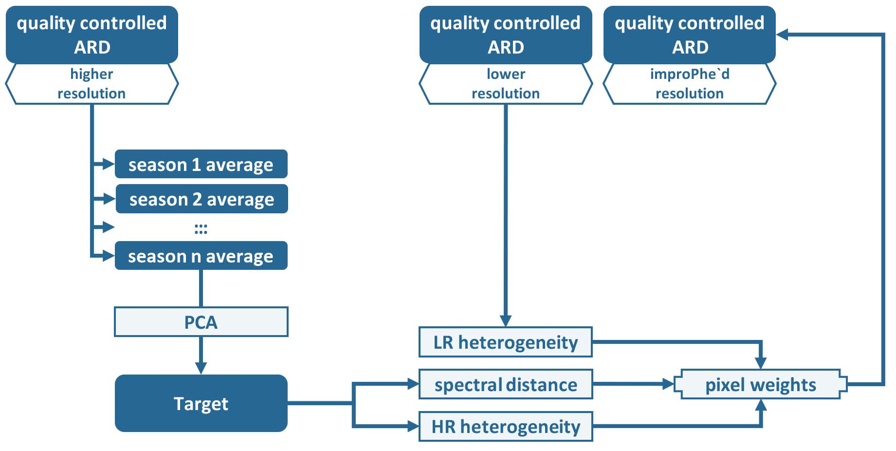
Figure Processing workflow of the Level 2 ImproPhe submodule.
Add more detailed description about workflow here. Make workflow image.
The higher-resolution ARD are condensed to seasonal windows, and the ImproPhe code is applied to each lower-resolution ARD dataset.
A glimpse of what you get:
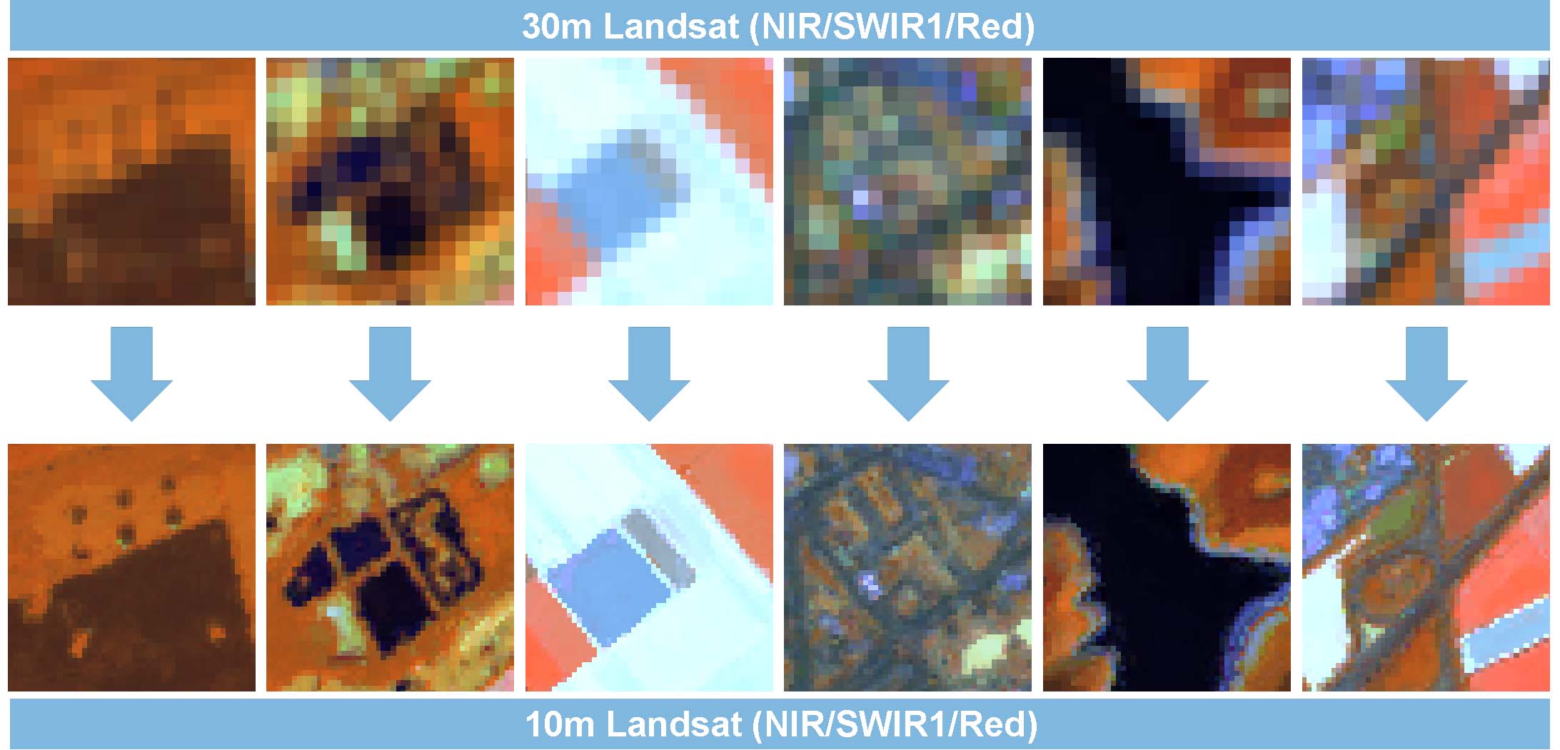
Figure 30m Landsat ARD, and ImproPhed 10m Landsat ARD. The figure shows image subsets from North Rhine-Westphalia, Germany. Using the ImproPhe algorithm, the spatial resolution was improved to 10m using multi-temporal Sentinel-2 A/B high-res bands as prediction targets.